
British Columbia Genealogical Society
Over Willison Bay near Atlin, BC
Photo Courtesy of Chris Albrecht
Welcome to the British Columbia Genealogical Society
We are a registered charitable organization with over 300 members from a variety of backgrounds and, like you, we all have an interest in researching our family history in British Columbia and beyond. We hope you will consider joining our Society.
The Library is OPEN Tuesdays, Thursdays and Saturdays from 10 am - 3pm. Visit us to check out our collection of more than 21,000 books as well as maps, journals and other resources.
〰️
The Library is OPEN Tuesdays, Thursdays and Saturdays from 10 am - 3pm. Visit us to check out our collection of more than 21,000 books as well as maps, journals and other resources. 〰️
The BCGS would like to acknowledge the ceded and unceded Indigenous ancestral territories of BC and Canada. We are grateful for the opportunity to learn the history, culture and traditions of the First Nations Peoples, alongside our personal investigations of familial settler history and encourage everyone to reflect on the Indigenous history of the lands where they reside.

BCGS Activities and Highlights
-

Scandinavia Coffee Chat Thursday 28 May
Join host Kathie Ross at 7 pm Thursday via Zoom for the Scandinavia Coffee Chat. If you have ancestors from Scandinavia, this is the chat for you!
Everyone is welcome. If you haven’t signed up, click on the button below.
-

Highlighting our members' blogs
Member Carol Mackay runs this blog - check it out!
The 929 Bookcase is where you'll find book reviews about genealogy-related books, both new and old. And, if you're the author of a genealogy guidebook or text, I'd love to review your book, too. Currently, I do not review genealogies.
I have written reviews for Quill & Quire, School Library Journal and other reviewing publications. -
Members' Meeting , 7:30 pm June 10th.
Speaker: Marisa Cooper
Beyond the Paper Trail: Leveraging Y-DNA and Documentation to Reconstruct the Neill/McNeil LineageMarisa successfully identified the Most Recent Common Ancestor (MRCA) for two distinct Neill and McNeil lines dating back to the 1700s. This involved detailed haplotype analysis to resolve deep paternal signatures and confirm the MCRA progenitor where paper trails were insufficient.
Calendar of Upcoming BCGS Local & Zoom Events
10 June 2026
BCGS Members’ Meeting
via Zoom
Speaker: Marisa Cooper
Members Chat - 7:00 - 7:30 pm
Meeting Starts - 7:30 pm
Members will receive a ZOOM invitation a few days ahead of the meeting. Non-members please contact info@bcgs.ca.
“What’s Up” In Genealogy in BC and Beyond
-
![]()
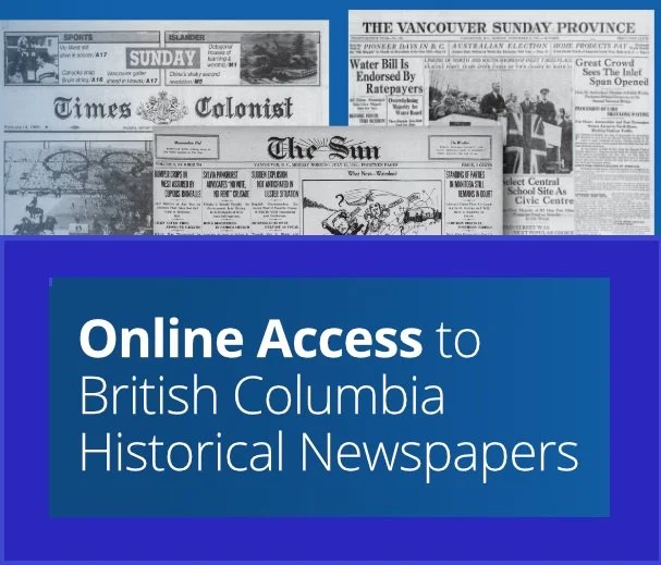
ProQuest - Online Access to BC Newspapers
ProQuest provides free online access to past issues of the Vancouver Sun (1912-2010), Vancouver Province (1894-2010) and Victoria Times Colonist 1884-2010) for anyone in B.C. or the Yukon.
-
![]()
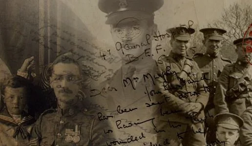
Canadian Letters and Images Project
Canadian Letters & Images Project - A digitization project for those who served Canada in conflict or war. Learn how you can contribute and what has already been digitized.
-
![]()
Legacy Family Tree Webinars
The world’s most popular webinar website for genealogy and DNA testing, where you can enjoy a robust offering of live and recorded webinars presented by top speakers. Over 2000 webinars to choose from.